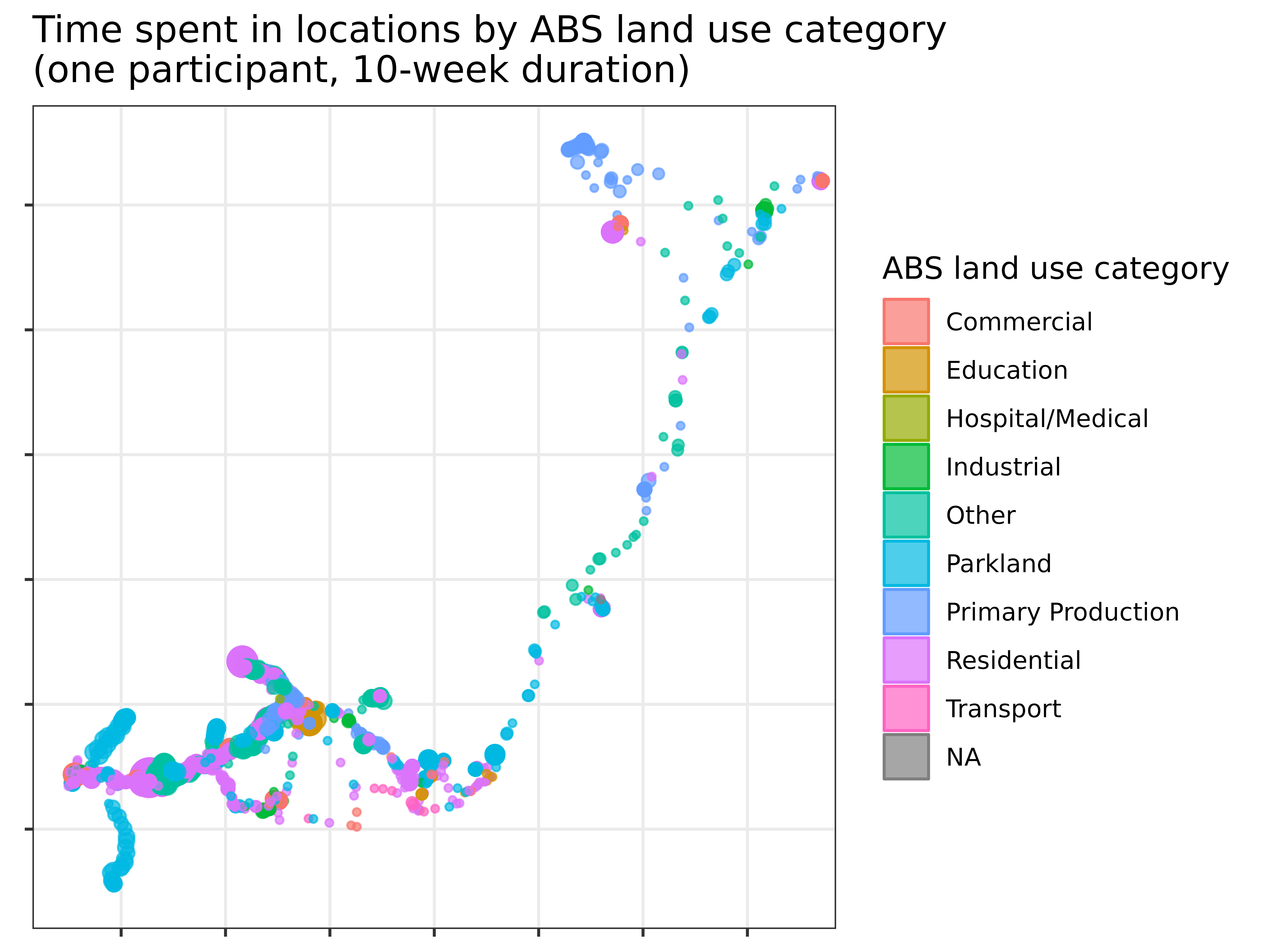
Figure 1: This map was generated with the R library sf, using latitude and longitude data collected via a mobile phone app linked to shapefiles from the Australian Bureau of Statistics.
Latitude and longitude data has been removed from the axes to protect participant confidentiality.